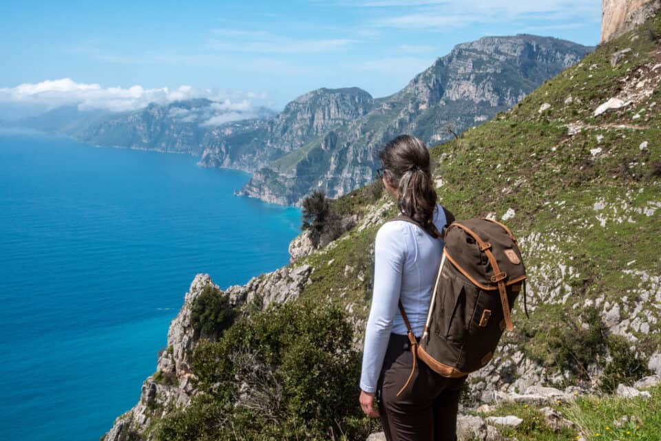
New Zealand is a paradise for outdoor enthusiasts, offering a wide range of walks and hiking tours across its diverse natural landscapes. The North Island and the South Island are different but both breathtakingly beautiful. From mountains and glaciers to pristine beaches and lush forests, the country offers a wide array of natural wonders.
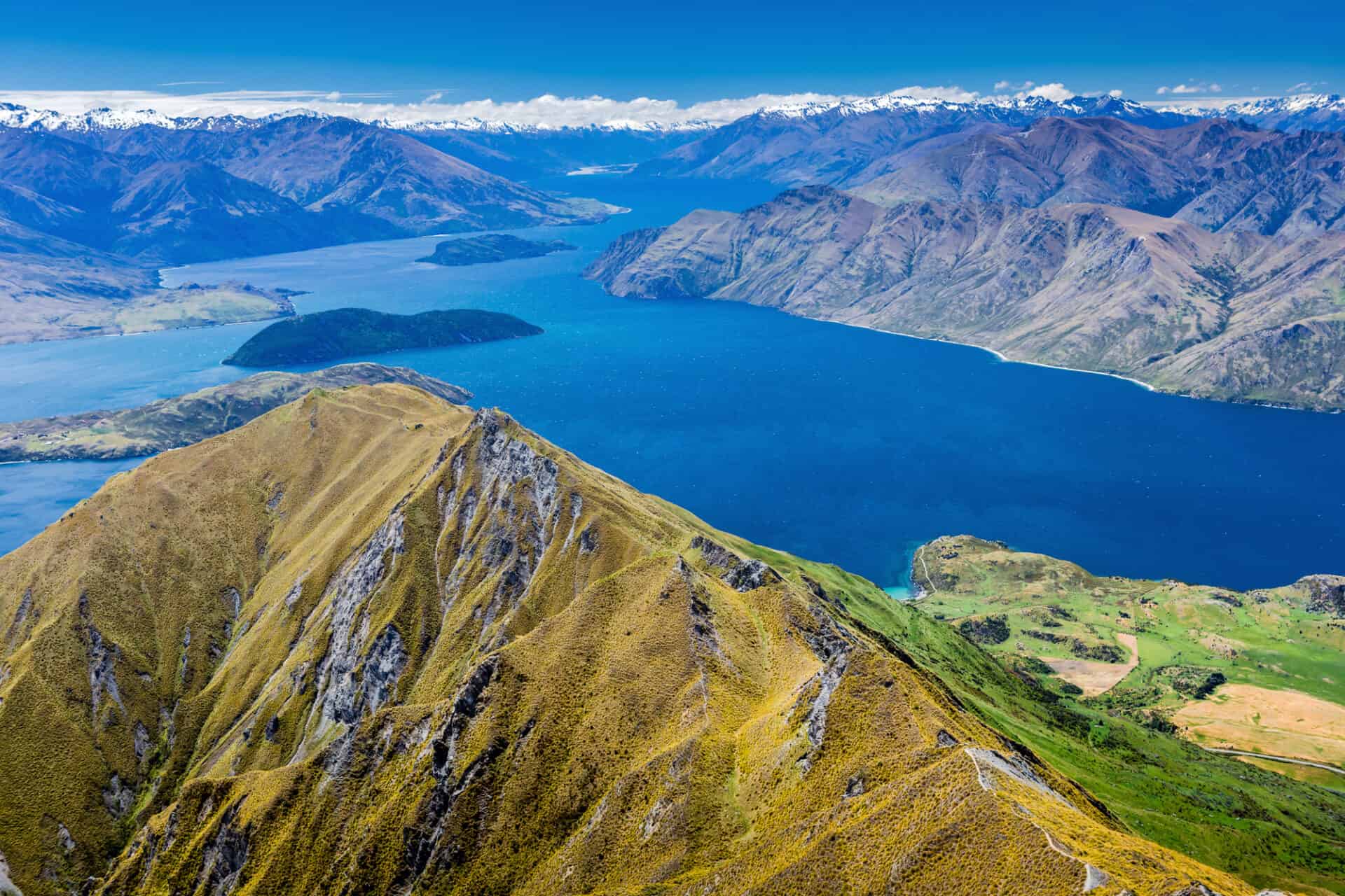
New Zealand is home to fiords and sounds, such as Milford Sound, Doubtful Sound, and the Marlborough Sounds. The Southern Alps, stretching the length of the South Island, offer majestic mountain ranges, including Aoraki/Mount Cook, the country’s tallest peak. The South Island is famous for its glaciers, Franz Josef Glacier and Fox Glacier. These massive rivers of ice flow down into lush rainforests, creating a striking and unique combination of ice and temperate vegetation. New Zealand also showcases its volcanic activity with sites like Tongariro National Park on the North Island, featuring active volcanoes and picturesque landscapes.
New Zealand boasts numerous national parks that preserve and showcase its natural beauty. Fiordland National Park, Abel Tasman National Park and Mount Aspiring National Park are a few examples of the country’s protected areas, offering diverse ecosystems and outdoor recreation opportunities. The coastline is adorned with beaches, from the golden sands of Ninety Mile Beach and Cathedral Cove to the dramatic cliffs of the Catlins. The forests, including the native rainforests of Fiordland and the kauri forests of the North Island, are home to a wide range of plant species. Additionally, New Zealand is famous for the kiwi, kakapo, and kea. Visitors can go whale watching in Kaikoura, swim with dolphins in the Bay of Islands, or explore the underwater world while diving in the Poor Knights Islands Marine Reserve.
Some of the walks and hiking tours in New Zealand/ Aotearoa (Land of the Long White Cloud):
Milford Track
The Milford Track (53km/33mile) is one of New Zealand’s most renowned hiking trails, located on the South Island. Often referred to as the “finest walk in the world,” the Milford Track starts at the head of Lake Te Anau and takes you through Fiordland National Park’s dramatic landscapes, including lush forests and glacial valleys. Reach the highest point of the track at Mackinnon Pass, which provides panoramic views of the surrounding peaks and lakes. Marvel at the Sutherland Falls, one of the tallest waterfalls in New Zealand. The Milford Sound is a breathtaking fiord located within the Fiordland National Park and can be explored by boat cruises or kayaking trips, allowing you to admire the sheer rock faces, cascading waterfalls, and the rich marine life, including seals, penguins and dolphins.
The track is typically walked over four days. There are three huts on the Milford Track, which must be booked in advance. The Fiordland National Park is a UNESCO World Heritage Site, known for its exceptional natural beauty. It is essential to practice Leave No Trace principles, respect the environment, and follow any guidelines and regulations in place to preserve the pristine nature of the area.
Tongariro Alpine Crossing
The Tongariro Alpine Crossing is a hiking trail located in Tongariro National Park on the North Island of New Zealand. The trail is typically accessible during the summer months (November to April). Tongariro Northern Circuit starts and ends in Whakapapa Village. This day hike offers a unique opportunity to walk through an active volcanic area with vibrant turquoise-colored lakes, steam vents and the three main volcanoes of Tongariro, Ngauruhoe, and Ruapehu dominating the skyline. Ngauruhoe, known as Mount Doom in the “Lord of the Rings” movies, is an iconic cone-shaped volcano along the route. As you hike, you will encounter a range of alpine plants and wildlife adapted to the harsh volcanic environment. Keep an eye out for native birds, including the New Zealand falcon (kārearea) and the rare blue duck (whio).
Abel Tasman Coast Track
Located in Abel Tasman National Park in the South Island of New Zealand, this track offers a wonderful combination of coastal and forest landscape, it features golden beaches, turquoise waters, and lush coastal forests. Some notable beaches and bays along the track include Anchorage Bay, Bark Bay, and Awaroa Bay. As you hike, you will have the chance to encounter a variety of native wildlife and bird species, including weka, penguins, seals, and a range of seabirds. The track is also home to native forests, with a rich diversity of plant life, including towering ferns and ancient trees.
The Abel Tasman Coast Track is a great option for both day trips and multi-day hikes. Most visitors walk in one direction on the Coast Track and get a water taxi back. Or they stay in one of the huts, lodges or campsites, which must be booked in advance. Water taxis operate along the coast, allowing you to access different points along the track. This provides flexibility for hikers to choose their starting and ending points. The full Abel Tasman Coast Track stretches for approximately 60 kilometers (37 miles) from Marahau in the south to Wainui Bay in the north. The track can be completed in 3 to 5 days, depending on your pace and the side trips you choose to take.
Abel Tasman National Park is known for its conservation efforts, and visitors are encouraged to respect the environment and follow the principles of Leave No Trace. It is important to carry out any waste and minimize your impact on the fragile ecosystems along the track. Whether you choose to hike the entire track or explore specific sections, you will be rewarded with breathtaking views, serene beaches, and a chance to connect with nature in a truly remarkable setting.
Kepler Track
This track is a popular multi-day hiking trail in Fiordland National Park on the South Island of New Zealand. The Kepler Track starts and finishes near Te Anau, a town known as the gateway to Fiordland. Water taxis can also be utilized to access different parts of the track. The Kepler Track is known for its alpine landscapes and the majestic mountains: Mount Luxmore and Mount Kepler. You will also encounter picturesque lakes such as Lake Te Anau and Lake Manapouri, which add to the scenic beauty of the area. Along the track, you can take a short detour to explore the Luxmore Caves, a system of limestone caves with fascinating rock formations and subterranean features. The Kepler Track is home to a variety of native New Zealand flora and fauna. You may encounter birds such as the kea, tui, and bellbird, as well as beech forests and alpine vegetation.
The full Kepler Track loop covers a distance of approximately 60 kilometers (37 miles) and typically takes 3 to 4 days to complete. There are Department of Conservation (DOC) huts along the track, providing accommodation for multi-day hikers. These huts offer basic facilities and require advance booking. Camping is also permitted at designated campsites, but it is essential to obtain camping permits and adhere to guidelines.
Routeburn Track
Passing through Fiordland and Mount Aspiring National Parks, the Routeburn Track, on the South Island of New Zealand, showcases waterfalls, rivers, mountains and panoramic views. Along the track, you will encounter Harris Saddle, the alpine scenery of the Routeburn Valley and the views of the Humboldt Mountains and Mount Aspiring. You will pass through ancient beech forests, with towering trees draped in moss and vibrant ferns. The area is also home to bird species like the endangered rock wren (piwauwau) and the native New Zealand robin (toutouwai).
The full Routeburn Track spans approximately 32 kilometers (20 miles) and typically takes 2 to 3 days to complete. Most hikers are staying at Routeburn Falls and Lake Mackenzie Huts. The Routeburn Track can be accessed from two different points: the Routeburn Shelter near Glenorchy and The Divide near Te Anau. Transport options, including bus and shuttle services, are available to reach the starting points and return from the endpoint.
The Routeburn Track is classified as one of New Zealand’s Great Walks, a collection of premier walking tracks renowned for their natural beauty and well-maintained facilities. Due to its popularity, it is recommended to book huts and campsites in advance, particularly during the peak season (late November to April).
Heaphy Track
Located in Kahurangi National Park on the South Island of New Zealand, this hiking trail offers a mix of coastal and forest scenery, river crossings, and diverse landscapes. The track traverses a variety of ecosystems, from dense rainforests to subalpine tussock fields. This creates opportunities to spot a diverse range of native flora and fauna, including birds like kiwi, kaka, and weka, as well as plants like nikau palms and giant rata trees. The full Heaphy Track spans approximately 78.4 kilometers (48.7 miles) and typically takes 4 to 6 days to complete.
The Heaphy Track features a series of Department of Conservation (DOC) huts scattered along the trail. These huts provide basic facilities and require advance booking. Camping is allowed at designated campsites, but permits are necessary. The Heaphy Track is relatively remote, and access to the trailheads can be limited. It’s recommended to have your own transportation or arrange shuttles in advance. You can start the track from Brown Hut in Golden Bay or Kohaihai on the West Coast.
Rakiura Track (Stewart Island)
The Rakiura Track, also known as the Stewart Island Track, is a scenic hiking trail located on New Zealand’s third-largest island, just south of the South Island. This track takes you through remote landscapes on Stewart Island, with the opportunity to spot native wildlife, including kiwi birds (most are active during the night), weka, tui, bellbirds, and the rare Stewart Island robin. Along the coast you can also spot little blue penguins, seals and dolphins. The beautiful sandy shores, such as Maori Beach and Port William, offer opportunities for enjoying the tranquility of the remote island environment. The full Rakiura Track is approximately 36 kilometers (22 miles) long and takes around 3 days to complete. The Department of Conservation (DOC) manages several huts along the Rakiura Track, providing accommodation for hikers. The track is well-marked and maintained, making it accessible for hikers of varying experience levels. The weather on Stewart Island can be unpredictable, and rain is common throughout the year.
Rakiura/Stewart Island has a rich cultural heritage. The track passes through areas of historical significance, such as Maori midden sites and European settlements. You will have the chance to learn about the island’s past and its ties to both Maori and European history and traditions. To access Rakiura/Stewart Island, you will need to take a ferry from Bluff, which is located near Invercargill on the South Island. Regular ferry services operate to Oban, the main settlement on the island. Oban serves as the starting and ending point for the Rakiura Track.
Lake Waikaremoana Great Walk
The Lake Waikaremoana Great Walk is a hiking trail in Te Urewera National Park on the North Island of New Zealand, a 46-kilometer (29-mile) loop track that circles Lake Waikaremoana. This track offers beautiful views of the lake and waterfalls, and from Panekire Bluff. Te Urewera National Park is renowned for its ancient and untouched forest. Walking along the trail allows you to immerse yourself in the lush native vegetation, including towering trees, ferns, and an array of native birdlife. Keep an eye out for the enchanting bird species, including the iconic kiwi. The area holds great cultural significance for the local Māori community, with a rich history of settlement and traditional practices. You may encounter Māori carvings, cultural sites, and stories that connect the landscape to Māori mythology and history, adding a deeper cultural dimension to your hike.
The Lake Waikaremoana Great Walk takes approximately three to four days to complete. The start of the Great Walk is at the village of Onepoto, the closest major town is Rotorua, which offers transport options to the trailhead. To hike the Lake Waikaremoana Great Walk, you will need to obtain a Great Walks hut pass from the Department of Conservation (DOC). It’s recommended to book accommodation in advance, particularly during the peak season (October to April). Camping is permitted in designated areas.
Mueller Hut Track
The Mueller Hut Track is a hiking trail located in Aoraki/Mount Cook National Park on the South Island of New Zealand. This alpine track offers views of New Zealand’s highest peaks and glaciers. The Mueller Hut Track is a challenging trail that leads to the Mueller Hut, perched at an elevation of 1,800 meters (5,900 feet) on Sealy Range. The track starts near the White Horse Hill Campground and offers views of Aoraki/Mount Cook, Hooker Valley, and the Southern Alps. Once you reach Mueller Hut, you will be rewarded with panoramic views and the chance to spend the night in a cozy alpine shelter. The hut provides basic facilities and it is advisable to book accommodation well in advance. The Mueller Hut Track is most popular during the summer months (November to April) when the weather is generally more favorable.
The Mueller Hut Track requires a good level of fitness and some hiking experience due to its challenging nature. It’s important to be prepared for the physical demands of the hike, including steep ascents and descents, rocky terrain, and potentially adverse weather conditions. Prior hiking experience on alpine trails is beneficial.
Te Araroa Trail
For those seeking a long-distance hiking adventure, the Te Araroa Trail spans the entire length of New Zealand, from Cape Reinga in the north of the North Island to Bluff in the south of the South Island. Te Araroa means ‘The Long Pathway’ and the trail takes around four to six months, covering approximately 3,000 kilometers (1,864 miles). Hikers will encounter picturesque coastlines with sandy beaches and dramatic cliffs, dense native forests, volcanic landscapes, alpine crossings, and scenic lakes and rivers. The route showcases the diverse natural beauty that New Zealand is famous for. Te Araroa is divided into 12 official sections, ranging from short walks to multi-day hikes. Hikers can choose to complete the entire trail or focus on specific sections based on their preferences, time, and fitness level.
Te Araroa provides opportunities to learn about the cultural and historical significance of New Zealand. The trail passes through areas of Māori heritage, where hikers can learn about the traditions and history of the indigenous people. It also connects with historic landmarks and settlements that showcase New Zealand’s colonial past.
More information about the Te Araroa Trail
New Zealand’s weather can be unpredictable, so it’s important to be prepared for changing conditions. Check trail conditions, weather forecasts, and make sure to have appropriate gear before embarking on any hike. Many of these tracks require booking huts or campsites in advance, especially during the peak season (the summer months: December through to March), so plan ahead to secure your accommodation.
The Department of Conservation (DOC)
The Department of Conservation (DOC) is the government agency charged with conserving New Zealand’s natural and historic heritage. The Great Walks season is from October until April. Find places to go walking and tramping in New Zealand: Walking and tramping
DOC manages a network of over 950 huts of all shapes and sizes. They provide unique places to stay, refuge from bad weather, or rest and recover when you’re out exploring the outdoors: Stay in a hut
Choose from more than 200 campsites in forest settings, lakeshores and sandy beaches: Stay at a campsite
This article is part of the series by Conscious Travel Guide, your resource for mindful globetrotting.
